


Article by Helen Jones, National Assembly
Research Service How long does it take to drive to a major A&E hospital? The map below gives an indication of the approximate time it would take to drive to your nearest major A&E hospital. Major A&E hospitals provide resuscitation, assessment and treatment of acute illness and injury in patients of all ages. Services must also be available 24 hours a day. Drive times have been calculated using the 13 major A&E hospitals in Wales and 4 major A&E hospitals in England that are close to the border. Drive times are based on people using the existing road network and have been categorised into the following zones; 0 to 10 minutes, 11 to 30 minutes, 31 to 60 minutes and over 60 minutes. The edge of each of the drive time zones has been simplified to improve readability and highlight the illustrative nature of the map. Figure 1: Drive time to major A&E hospitals in Wales and England 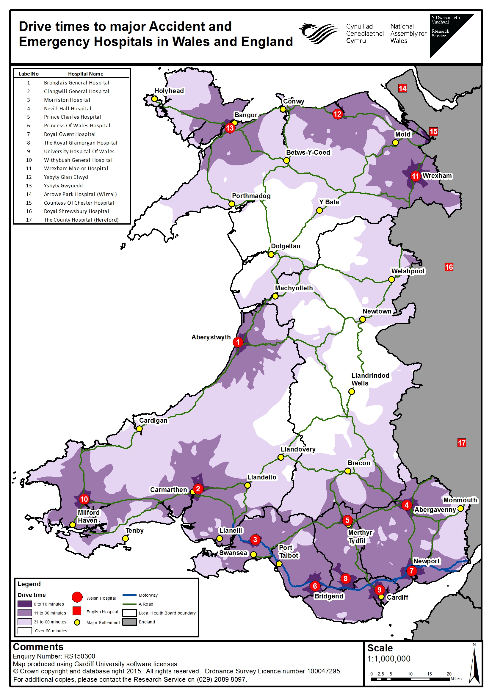 How many people live within each drive time zone? Using the Office for National Statistics (ONS) 2013 mid-year population estimates at output area level (small geographical areas) it is possible to estimate how many people live within each of these drive time zones. Unsurprisingly, Table 1 shows that the majority (98.4%) of people in Wales live within 60 minutes of a major A&E hospital. Only 14.1% of people live more than 30 minutes from a major A&E hospital. Table 1: Estimated population in each drive time zone
 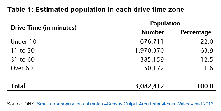 What are the limitations of this map? The purpose of the map is to give a broad visual indication of the time it could take to drive to a major A&E hospital from different parts of Wales. Although the results displayed here have been spot checked for accuracy using Google Maps’ directions tool, they should be treated with caution. The distance travelled within a specified period of time depends on many factors which are difficult to model, such as time of day, vehicle type, traffic congestion and road works. The model used here also assumes that all roads of the same type (eg. an ‘A Road’) have the same average speed across Wales. This is not the case as speed limits vary within road types. For instance, the speed limit of ‘A Roads’ varies between 40mph and 70mph, and this will have an impact on the average speed. Additionally, the edge of each drive time zone has been simplified to improve readability which slightly reduces the level of accuracy. The Research Service can produce similar maps for Assembly Members and their staff showing drive time to other services in Wales.
