Article by Graham Winter, National Assembly for Wales Research Service
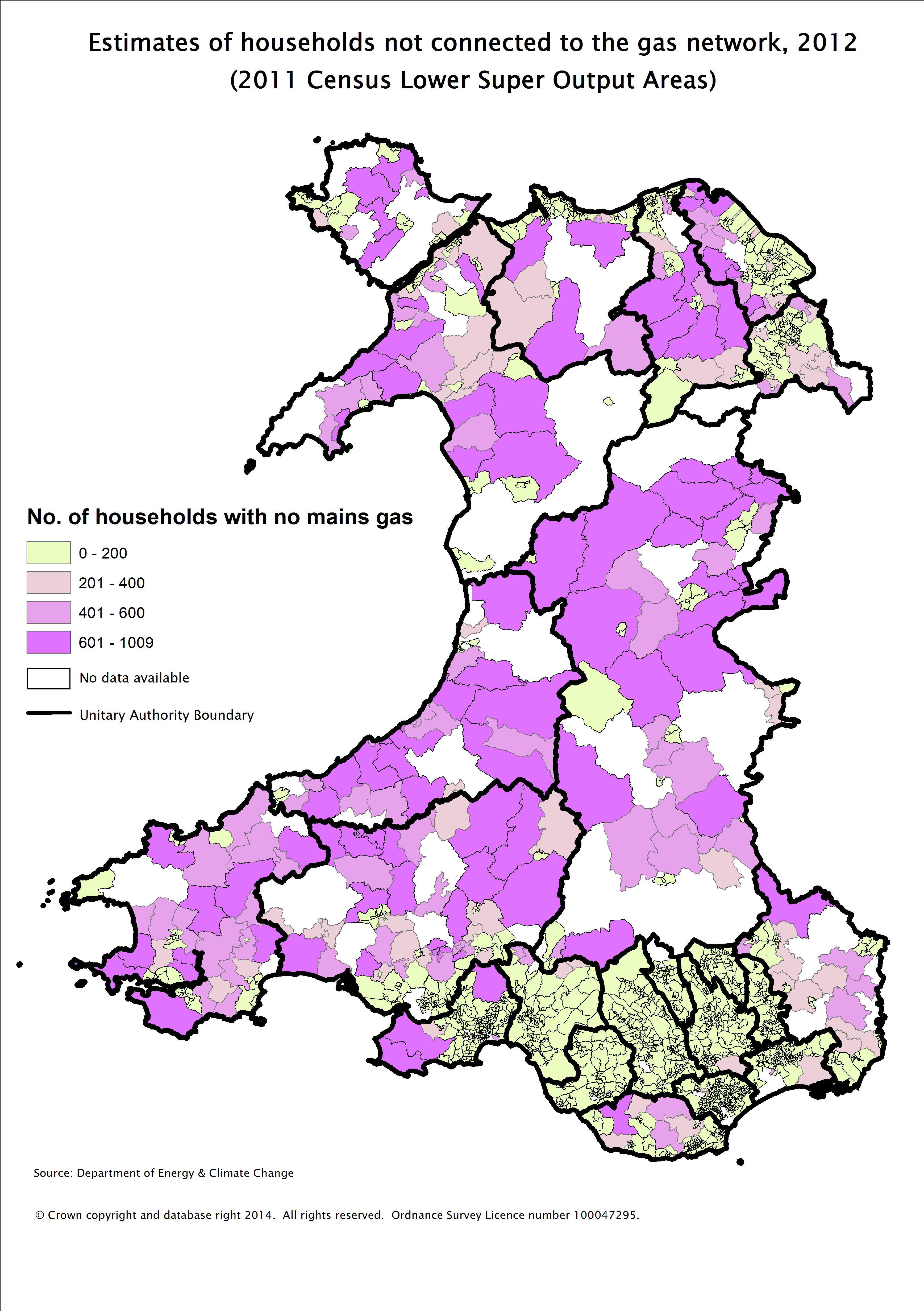
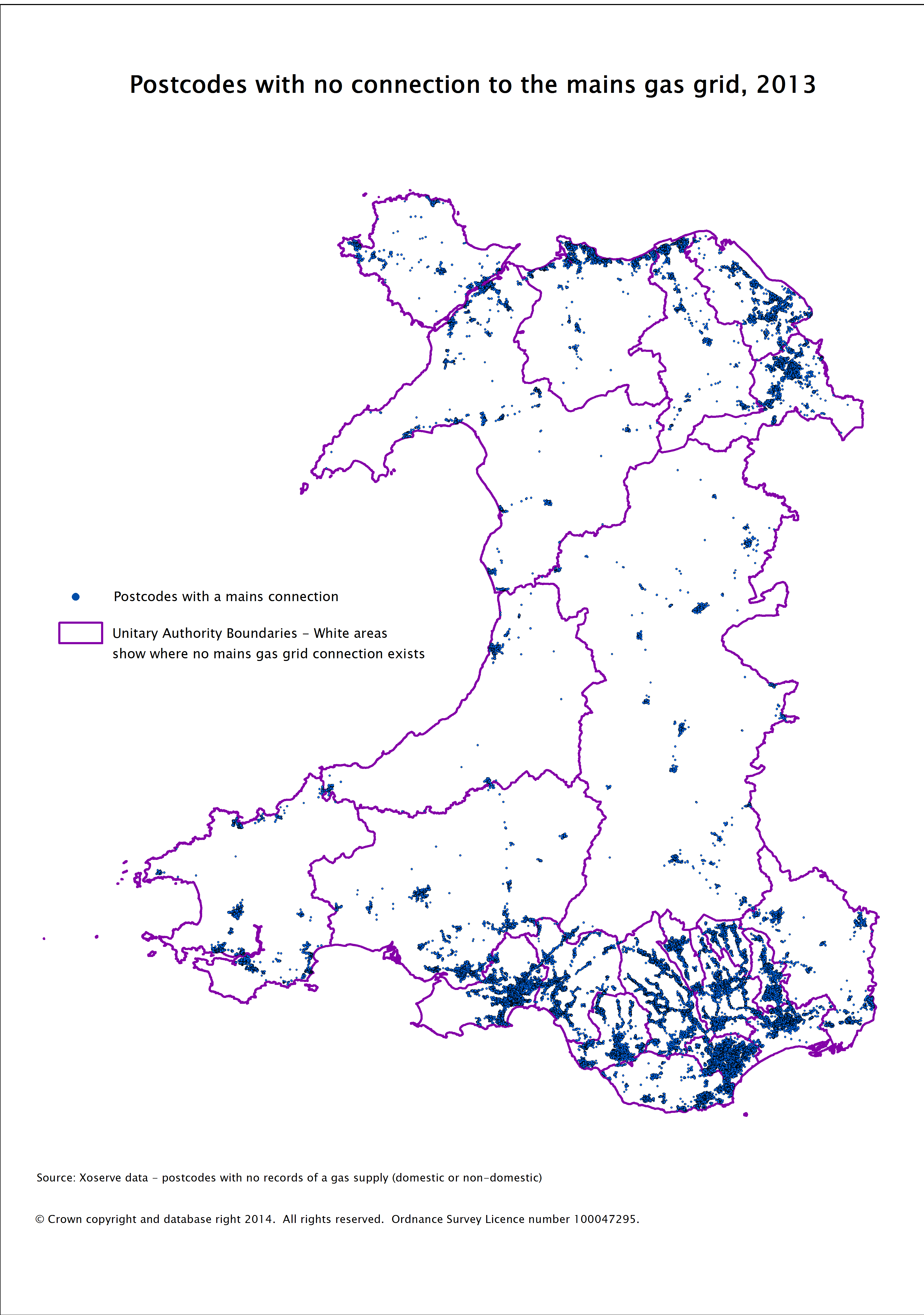
Fuel poverty is defined as needing to spend more than 10% of household income on energy in order to heat the home to an acceptable level. In 2008, 332,000 households in Wales were estimated to be fuel poor. In rural Wales the proportion of households in fuel poverty was 42 per cent in 2008; almost double that of fuel poverty in urban areas, which was 22 per cent. Rural households often use fuels other than gas to heat their homes as they are more likely to be off the gas mains network. The Welsh Government estimates that the total number in fuel poverty in Wales had increased by an additional 54,000 to 386,000 households in 2012. The Department of Energy & Climate Change (DECC) has recently produced some estimates of the number of households who don’t have access to the gas mains network across Great Britain. It estimates that 15% of all households didn’t have access to mains gas in Wales in 2012 (about 195,000 households). According to DECC this compares to an average of about 10% for England, 18% for Scotland and 11% for Great Britain as a whole. The Welsh Government’s own estimate of the number of properties without mains gas in Wales is somewhat higher at about 264,500 dwellings. The map below shows the estimated number of households by 2011 Census Lower Super Output Area (LSOA) that were not connected to the gas network in 2012. Note that for a few LSOAs no data is available.  The map clearly shows that most households have mains gas in the urban areas in the north and south, whilst many rural parts of Wales have a higher number of households without mains gas. Apart from most of mid and west Wales and many parts of north Wales away from the coast and Flintshire/Wrexham, other areas that also stand out include the rural parts of the Vale of Glamorgan, Monmouthshire and the Gower. These last three aren’t areas that are traditionally associated with high levels of poverty. It is also possible to map individual postcodes that have no mains gas supply, either domestic or non-domestic. This map shows a similar pattern with a concentration of mains gas supply in the more built-up areas of Wales.
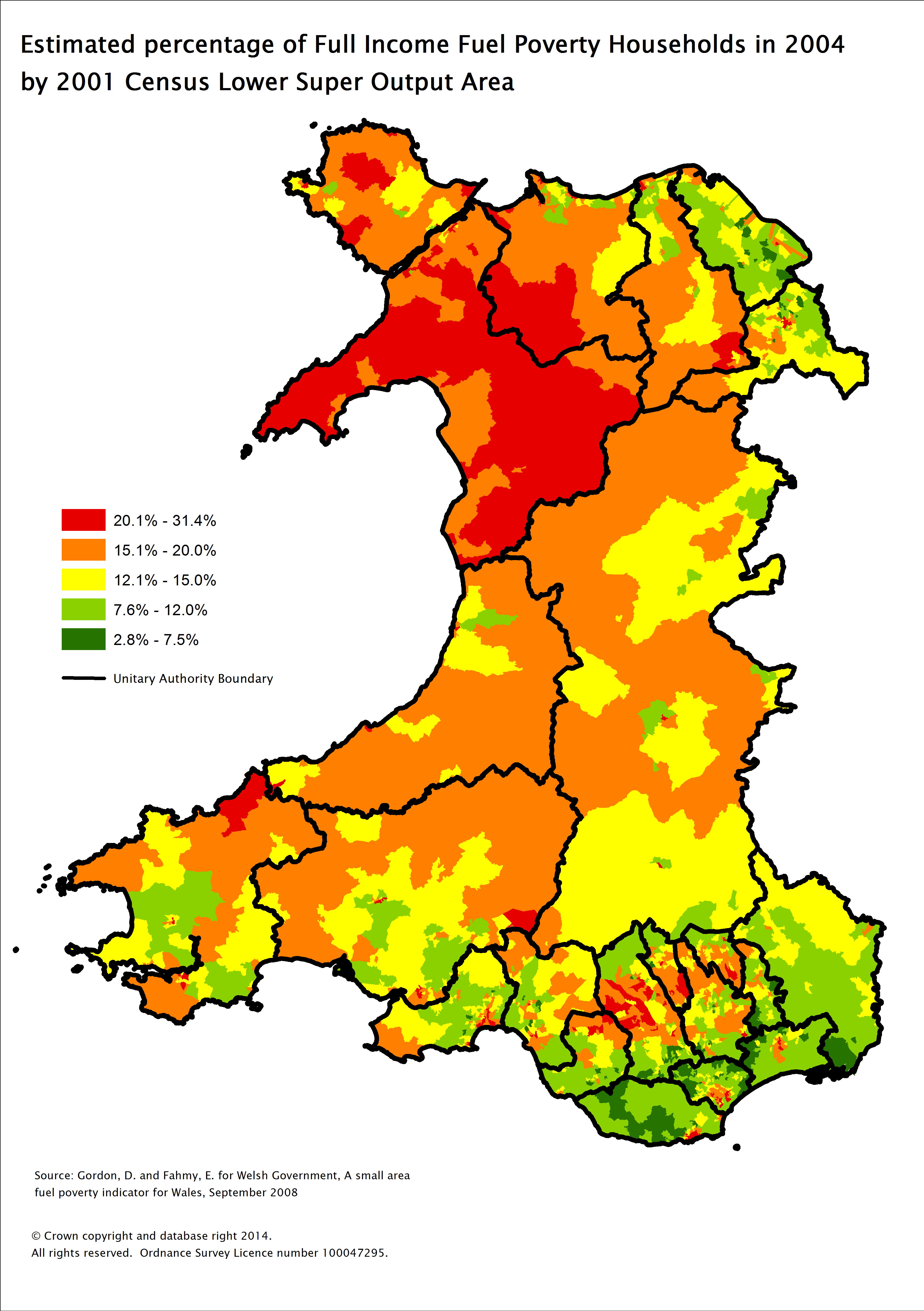
  The Welsh Government announced in 2013 that it will be undertaking a study to improve its understanding of the issues around housing and fuel poverty in rural areas and what might be done to reduce fuel poverty in these areas. The Welsh Government has previously published local fuel poverty maps for each local authority in Wales. As these were produced using data from the 2004 Living in Wales Survey and the 2001 Census, they are unlikely to accurately reflect levels of fuel poverty today, but remain useful as the relative concentration of fuel poverty between different areas is unlikely to have changed significantly. Data produced from this work and available on the Welsh Government’s website shows that the areas with the highest levels of fuel poverty when the study was conducted were in urban areas such as Cardiff, Swansea, Newport and Barry, the Valleys and also in some of the more remote rural areas – particularly in North West Wales.
  Looked at together these maps show that although the lack of a connection to mains gas may be a contributing factor to fuel poverty, there is not a direct correlation across Wales between areas off the gas mains network and areas with high levels of fuel poverty.


