Article by David Millett and Sam Jones, National Assembly for Wales Research Service
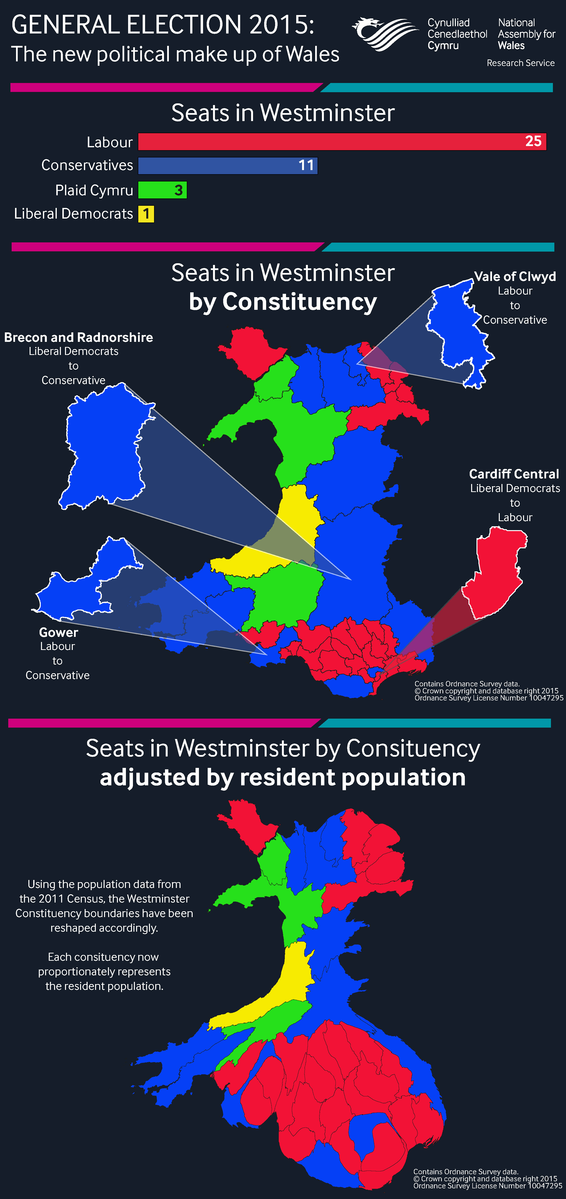
The General Election 2015 saw the political make up of Wales change with the Conservatives gaining seats from both Labour and the Liberal Democrats. The number of seats won in this election and the change from 2010 are as follows:
- Labour: 25 (down 1)
- Conservatives: 11 (up 3)
- Plaid Cymru: 3 (no change)
- Liberal Democrats: 1 (down 2)
Constituencies are roughly the same size in terms of the number of residents, but vary considerably in land area from large rural areas with a low population density to much smaller densely populated urban areas, especially in south Wales. This infographic aims to show the election results in Wales from both a traditional land area based approach, and a more proportional method using the resident population of the constituencies. The maps in the infographic show the seats won by each party but in two very different ways:
- The first map is a traditional Westminster constituency based map of Wales, where each constituency is displayed by its land area.
- The second map proportionately represents the population in each constituency. Taking the resident population data from the 2011 Census, the Westminster constituency boundaries have been reshaped to better reflect the number of people living in each constituency, whilst still maintaining the Wales boundary as a recognisable shape.
The second map is known as a cartogram, which shows the areas of Mid-Wales, which have fewer residents shrinking. Areas where larger numbers of people live, such as in the South East, particularly around the cities of Cardiff, Swansea and Newport, in the South Wales Valleys, and in the North around Wrexham and Flintshire have expanded. 


